GPS Analytics
Analysis of GPS data with Jupyter github
This repository is a Jupyter Notebook that accepts a GPX file or CSV of GPS locations and maps and analyzes the result.
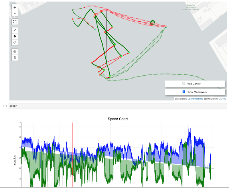
The code analyzes tacking/gybing angles and infers a wind direction based on them. From that, we can calculate VMG.
The data is mapped, colour-coded by tack and whether upwind or downwind. Points on the map can be scrubbed through using the speed chart below.
In addition, we can generate:
Violin Plot
a chart of the angles sailed between each maneuver. This allows comparing tacking angles, but also different multiple tacks or gybes on the same leg
Polar Plot
Shows avg and 90th percentile speed at every given compass angle. The data can also be filtered (in the event the wind shifts).